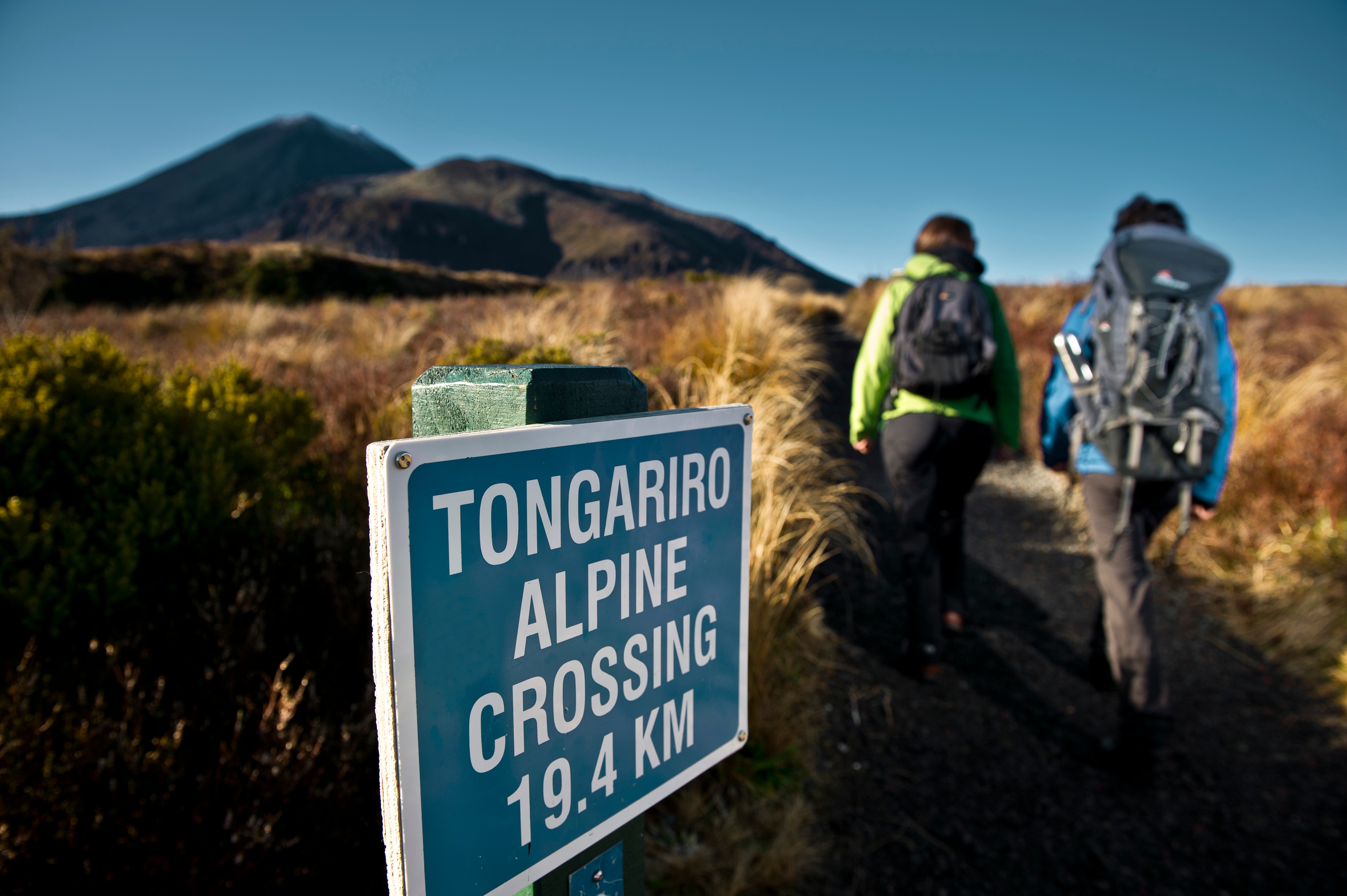
You're wanting to know more about the geology of the Tongariro Alpine Crossing, and how amazing it is.
But you don't have time to wade through heavy text books.
Well, here's a quick run down of the main features on the Crossing from start to finish.
And some back ground information for you too.
Here are the geological features you'll see on the Tongariro Crossing:
- Mangatepopo Valley
- Mangatepopo Saddle
- South Crater
- Mt Ngauruhoe
- Red Crater
- Oturere Valley
- North Crater
- Emerald Lakes
- Central Crater
- Blue Lake
- Te Maari Craters
- Ketetahi Hot Springs
The back story of Tongariro
The mighty Pacific Plate diving below the Indian-Australian Plate north of New Zealand. The Indian-Australian Plate diving below the Pacific Plate south of New Zealand.
These powerful forces caused a twisting motion. As a result, the land around Tongariro began to open up.
1.6 million years later these forces are still at play. Keeping the Tongariro volcanoes very much alive and kicking.
The earths crust continues to move today. The friction caused by the plates moving past each other creates enormous heat. Enough heat to melt rock. This melted rock is called molten rock or magma. The magma is sometimes forced to the surface of the earth and erupts from volcanoes.
The first eruptions of the Tongariro area started around 260,000 year ago. Around the time Homo sapiens, our direct ancestors were running around Africa.
Tectonic plate movement and volcanic eruptions are the main forces to shape Tongariro. But not the only force of nature to do so. Ice has also played a major part in forming the present day Tongariro landscape.
Glaciers have advanced and retreated several times over the last 250,000 years. The last glacier to melt in Tongariro was around 11,000 to 15,000 year ago. Around the same time sheep were domesticated in Mesopotamia.
Mangatepopo Valley
The grand entrance to the Tongariro Alpine Crossing is the Mangatepopo Valley. Stretching 4.5km from the trail head to the base of the Mangatepopo Saddle.
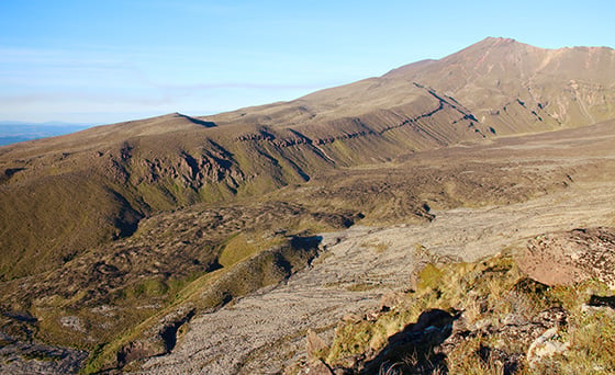
The last glacier carved out this valley. Lateral moraines, piles of rock debris are present along the valley walls.
Youngish lava flows from recent Mt Ngauruhoe eruptions are obvious at the head of the valley.
Mangatepopo Saddle
After leaving the valley the "good fun" begins.
The Mangatepopo Saddle is sometimes referred to as the Devils Staircase. For good reason. The ascent is approximately 300m from the foot of the saddle to the top.
The track passes over lava flows from Ngauruhoe's recent eruptions.
South Crater
The top of the saddle brings you to the edge of the South Crater. Which is not actually a crater.
Did you know the Greeks used large bowls called craters to drink wine from?
The Surrounding volcanic cones and glacial cirque formed the South Crater.
A bowl-shaped depression moulded by a glacier is visible at the northern head of the basin.
An explosion crater exists at the South East corner of the basin.
Here's Wikipedia's definition of a explosion crater:
"An explosion crater is a type of crater formed when material is ejected from the surface of the ground by an explosive event at or immediately above or below the surface." Thanks Wiki !
The walk across the South Crater is about 1.6km and is flat. A welcome rest after the climb from the Mangatepopo Valley floor.
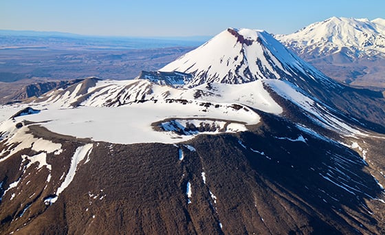
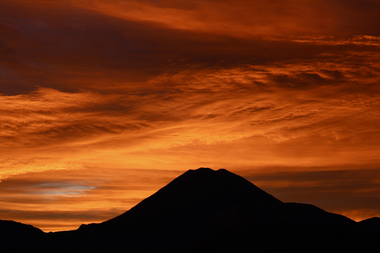
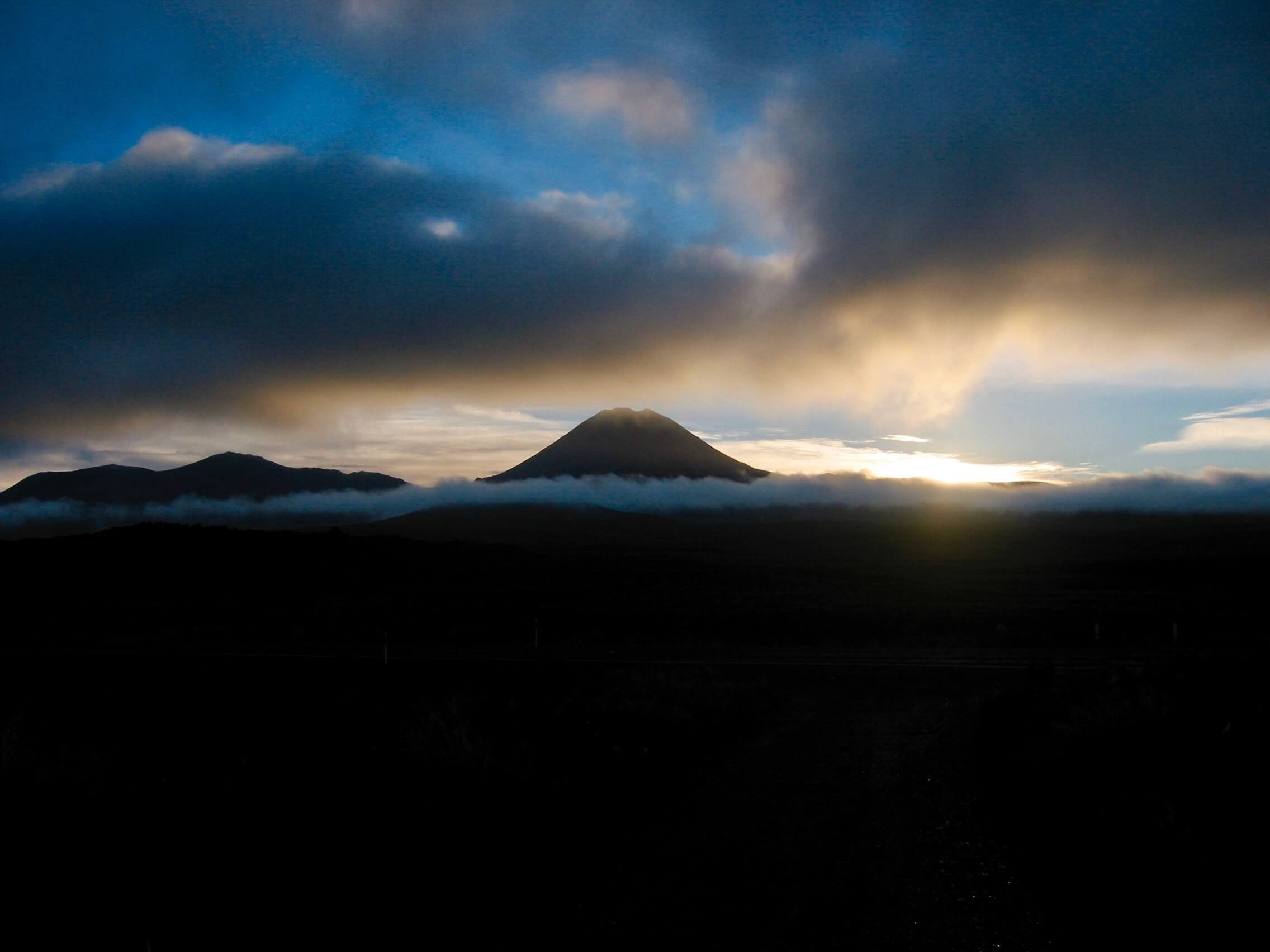
Mt Ngauruhoe
Strolling across the South Crater, you can't help but marvel at Mt Ngauruhoe to your right. Born between 1800 to 2500 years ago.
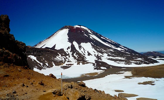
The conical shaped volcano is formed on the Southern flanks of Mt Tongariro.
Ngauruhoe has erupted 70 times over the last 150 years.
No eruptions have happened since 1975. Ngauruhoe is currently taking the longest break from an eruption since records began.
Over its lifetime it has erupted every 9 years, which makes it very active.
The 1975 eruption of Ngauruhoe saw rocks thrown 3km from the crater. Some the size of cars.
In 1954 Ngauruhoe blew lava bocks out some weighing a thousand tonne. Or about the same weight as 9 adult blue whales.
Red Crater
After leaving the South Crater you start the second and last "good fun" section.
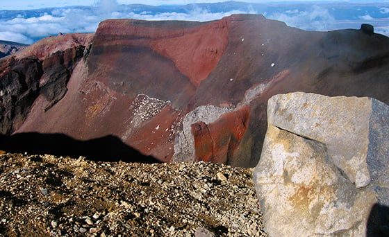
This climb takes you to the top of Red Crater at 1868m above sea level. This is the highest point on the Tongariro Alpine Crossing track.
The 300m ascent is pretty steep in places.
The Red Crater is still active. It began forming around 9,700 years ago.
There has been many explosive eruptions over the last 3000 years.
The last ash eruption from Red Crater was in 1926.
The crater gets it's red colours from the basalt scoria which is normally grey to black. High temperature eruptions have oxidised the iron in the scoria. You could say the red colour is a rusty red.
The 360 degree view from the top of Red Crater will take your breath away. On a fine day of course. You'll have to hike up there yourself to see what I mean.
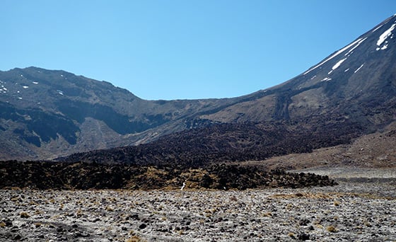
Oturere Valley
On the "good fun" climb to the peak of Red Crater you can enjoy views of the Oturere Valley.
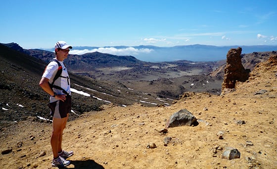
This valley has seen 100,000 years of volcanic activity. It was the site of one of Tongariro's original cones. Glacial erosion has removed most of this cone.
A large lava flow from Red Crater covered the valley between 2500 to 9700 years ago. The lava flow stretches 8km down the valley. It's up to 400m wide and up to 30m thick.
North Crater
If the weather is fine you'll see the North Crater from the Red Crater highpoint. It's not far beyond the Central Crater.
On top of the cone is a distinct flat area 1km wide. 10,000 years ago this flat area was a lake of lava. After some time it cooled and left this distinct level surface.
Eruptive activity of North Crater dates back at least 70,000 years.
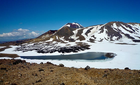
Emerald Lakes
From Red Crater you descend down to the Emerald Lakes.
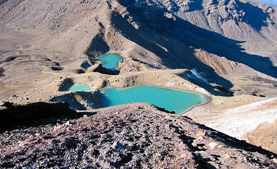
These three explosion craters were formed around 1800 years ago.
The colour of the lakes are spectacular, especially on a sunny morning. I still get goose pumps every time I see them.
Nature knows how to make amazing colour. In this case, sulphur from the earths crust seeps into the water and forms polysuphide ions. If you don't know chemistry this won't mean much. All you need to know is nature is amazing!
One of the lakes is up to 4.5m deep.
The pH ranges from 3 to 5, about the same as wine. At pH 4.2 all fish die, so there are no fish in these lakes.
Central Crater
The next section of the track takes you across the Central Crater.
Which like the South Crater, is not a crater. It was also carved out by glacial forces.
A nice feature of the Crater is an 1800 year old black basaltic-andesite flow from Red Crater. You'll see this in the southern half of the crater. It's quite distinctive.
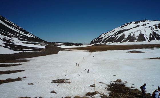
Blue Lake
A short walk across the Central Crater brings you to the Blue Lake.
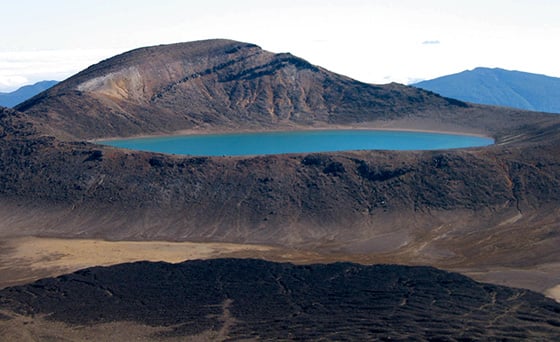
This crater was formed between 10,000 to 25,000 years ago.
It has a history of blowing out high temperature lava 500m above the crater. Imagine that next time you're there.
The stunning colour of the lake is due to minerals leaching into the water from the andesite rock.
The water is a little acidic at pH 5. This is about the same acidity as black coffee.
The lake is about 16m deep.
Te Maari Craters
From the Blue Lake its all downhill. But don't be tricked into thinking it's going to get easy. For many hikers this is the most challenging part of the track. It's a long way down!
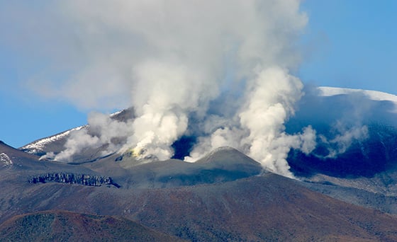
As you head down you'll see the smoking vents of Te Maari on your right.
These craters have seen a lot of activity going back 27,000 years. Early news paper reports record eruptions during 1869, 1886, 1892 and 1896.
The last lava flow from Te Maari was about 500 years ago. Or just after the first printing press was invented in England.
The last eruptions from Te Maari happened in 2012. On the 6th August around midnight a mighty gas and steam eruption threw rocks up to 2.2km from the crater.
The largest rock found was around three tonne. About the same weight as a hippopotamus, or a Blue whales tongue. Ash fell as far away as the Hawks Bay.
The August eruption closed the Tongariro Crossing track. There was no further significant seismic or volcanic activity from the vents.
So the Crossing was re-opened for the summer hiking season. And then boom! The crater erupted again on the sunny afternoon of the 21st November at 1:30pm. It pushed ash out up to 2km above the crater.
50 hikers were strolling past at the time. Luckily the light winds blew the ash away from the track. There were no hikers hurt. But many hearts beat. And many feet ran.
Ketetahi Hot Springs
The Ketetahi Hot Springs are further down the track from Te Maari.
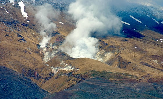
There's no evidence of any major eruptions from this site.
The location of the springs is at the head of the Mangatipua Valley. The hot water from the springs feed the Mangatipua Stream.
The springs are private Maori land and there has been no public access for many years now.
I was lucky enough to explore the springs when there was access. I have to say it was an awe-inspiring experience being amongst the springs. Close your eyes for a second.... and imagine being inside a kettle when it's boiling. The noise of the water boiling out of the ground was almost deafening. So much power.
The Ketetahi Hot Springs are often puffing away. On a fine day you can often see stream and gases rising above the springs from more than 70km away.
Tongariro still very much alive
So that's a quick rundown of the geology of the Tongariro Alpine Crossing.
The ancient volcanic history makes for a fascinating landscape. Add in the spectacular views and amazing sights this hiking journey is special.
With the earths crust still on the move Tongariro is still very much alive.
With all this going on it's hard to think of a more interesting one day hike in New Zealand.
Sources & more reading:
- Tongariro a sacred gift, by Craig Potton
- The restless land, by Department of Conservation & Tongariro Natural History Society
- Volcanoes of the South wind, by Karen Williams
- A volcanic guide to Tongariro National Park, by Karen Williams
Where to next...
Check out this planning guide for the Tongariro Crossing. It gives you all the information you need to help make your adventure a memorable one.
Share this
What's the Tongariro Alpine Crossing?
How To Prepare For Tongariro Crossing Weather
No Comments Yet
Let us know what you think